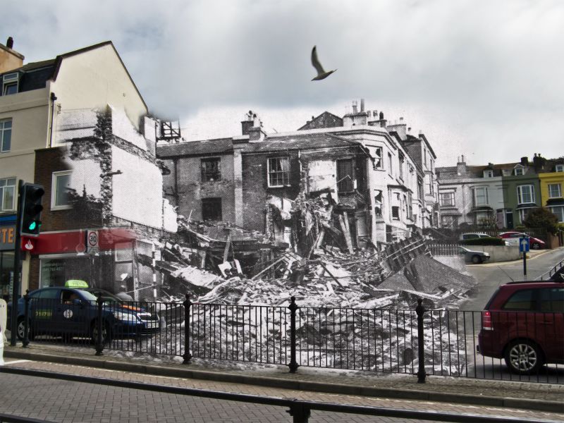
 Overview
The map below shows all of the WW2 bomb sites in Hastings and St Leonards. The location of the bomb sites has been provided by a map and supporting information from two books. Both of these books provide a rich and detailed overview of Hastings during the war. They are well worth a read:
- Hastings & St Leonards in the Front Line (first published by the Hastings and St Leonards Observer in 1945)
- Hastings at War 1939-1945, by Nathan Dylan Goodwin (published by Phillimore)
These publications have supplied key details about the air raids such as the location, names of the casualties and type of bomb and plane that dropped them. Both books contain a hand drawn map that show where the bombs landed. I have used this map to create the online map shown below. I welcome any corrections made by submitting a comment below or completion of the form found here.
Hastings and St Leonards was on the receiving end of 85 German air attacks for four years between 26th July 1940 and 8th August 1944.
During that period 550 high explosive bombs, 12 oil incendiary bombs, around 750 small incendiary’s and 15 V1 Doodlebug flying bombs fell on the town and surrounding area. These figures do not include the many bombs that missed the town and ended up in the sea.
These attacks demolished or damaged beyond repair 463 buildings and caused damage to 14,818 other buildings. The human cost included 154 civilians killed, 260 hospitalised and 439 slightly injured.
Impact of the Bombing
Hastings and St Leonards on the Front Line, written in 1945, describes the effect of the raids on the town.
“The months of September and October 1940 will ever remain memorable to those residents who had remained in the town after the official evacuation notices had been published…
Many valuable lives were lost; treasured homes in all parts of the Borough were reduced to hideous heads of debris; valuable business property was destroyed; the wail of sirens was unending; ducking for cover became a mere routine; and with it all was a bleak sense of helplessness accentuated by the absence at that time of any effective local defence against the raiders.
The lone bombers seemed to have it all their own way. They came in, often unheralded by sirens, circled the town at will, dropped bombs and machine-gunned streets, left their trail of devastation, and made off unchallenged. The town was not of sufficient military importance to lay claim to any of the country’s over strained defences. Britain was fighting for her life, and the A.A. guns and the fighter planes were needed for the defence of targets far more vital than a half-empty seaside resort.
This self evident fact, however, provided poor consolation to the townspeople, who daily saw more and more of their beloved Borough being laid in ruins, and it is to the everlasting credit of the defenceless men, women and children of the Premier Cinque Port that they carried on through those terrible days with unflagging calmness and courage. Under fire, they proved themselves to be of the same fine stuff as their kith and kin in the Fighting Services and as the people of London and the other major target areas whose ordeals were to prove so much greater than anything experienced by Hastings and St Leonards.”
Updates to the map will continue. View it in full screen by clicking the square icon in the top right hand corner.
I am guessing that the black dots are bombs, but what do the red circles mean, please ?
Hi Stephen. The red circles are where bombs, shrapnel and machine gun fire caused deaths. The black dots are where other bombs landed, but didn’t cause known deaths. Kind Regards, Kieron.